Pokhara to Muktinath: Distance, Road Conditions and Route Guide
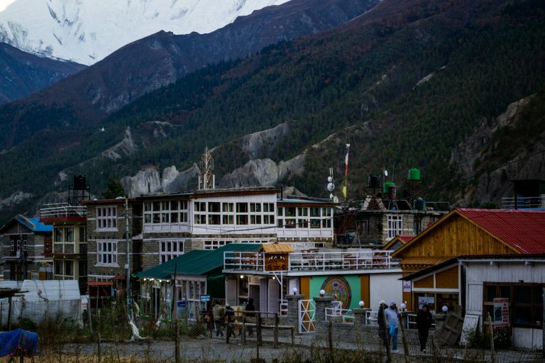
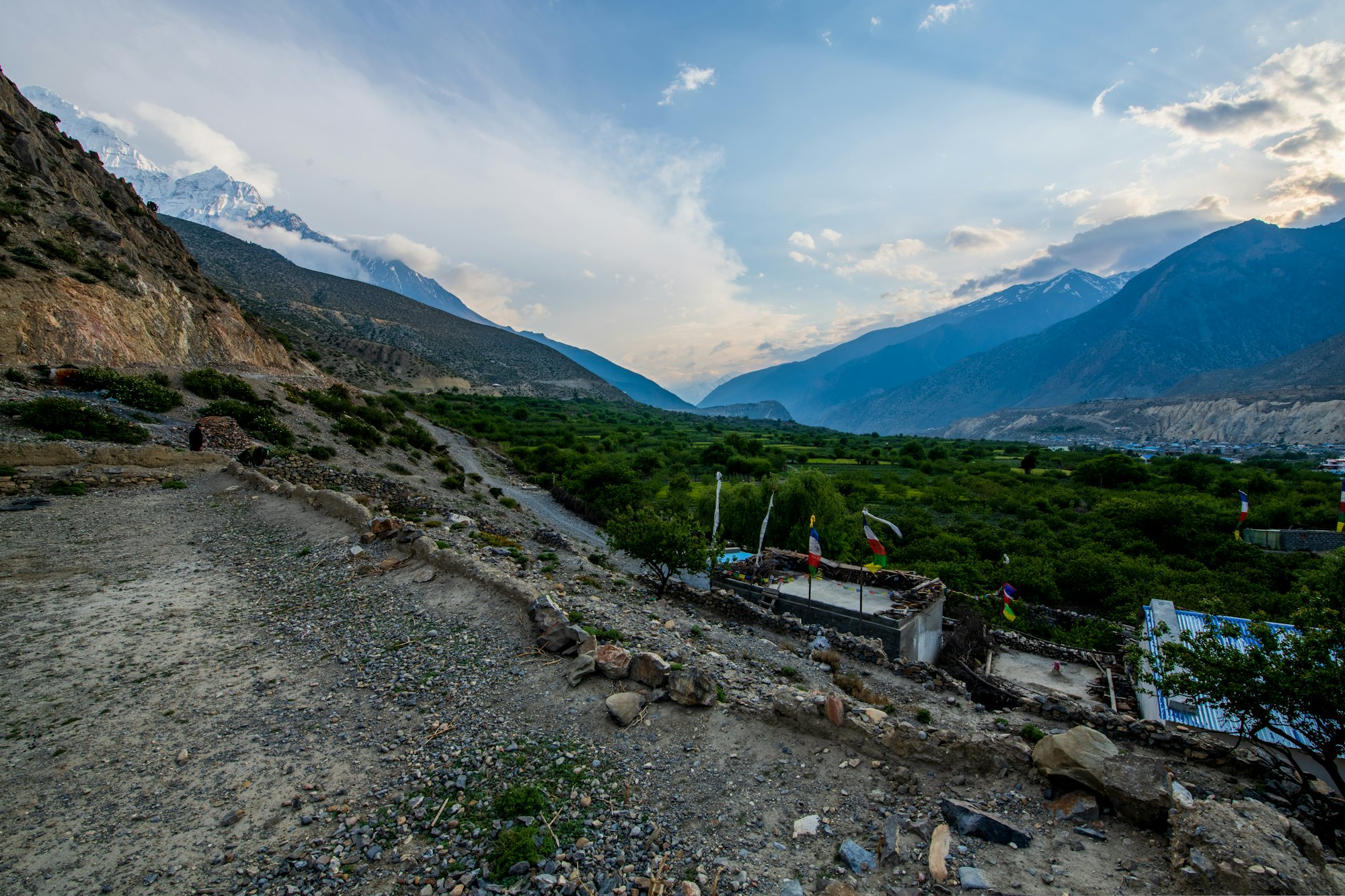
The road from Pokhara to Muktinath climbs almost 3,000 metres in under 190 km — from the subtropical Pokhara valley, through the Kali Gandaki gorge between Dhaulagiri and Annapurna, to the high, dry trans-Himalaya of Mustang. It is the most popular motorbike ride in Nepal and the main route for the jeeps and buses that carry pilgrims, trekkers and travellers to Jomsom and Muktinath.
This guide gives the distance section by section with altitudes, the state of the road in 2026, every way to make the journey (bus, jeep, flight, helicopter and motorbike) with typical prices, permits and checkpoints, fuel and facilities, the best stops and suggested itineraries.
| Pokhara to Muktinath at a glance | |
|---|---|
| Total distance | About 175–190 km one way (sources vary) |
| Pokhara to Jomsom | About 155–158 km |
| Jomsom to Muktinath | About 20–25 km |
| Altitude | From about 820 m (Pokhara) to about 3,710–3,800 m (Muktinath) |
| Driving time | About 9–12 hours in total; best split over two days |
| Road | Paved to Beni; mostly paved Beni–Jomsom with rough gorge sections; blacktop Jomsom–Kagbeni; paved switchbacks to Ranipauwa |
| Permit | ACAP (NPR 3,000 for foreigners); no restricted-area permit needed |
| Best time | March–May and October–November |
In this guide
- Distance and altitude, section by section
- What the road is like in 2026
- Ways to travel from Pokhara to Muktinath
- Permits and checkpoints
- The best stops on the way
- Suggested itineraries
- Fuel, money, food and phone signal
- Riding tips for the Kali Gandaki road
- Altitude on the road to Muktinath
- Can I continue to Manang?
- Best time to make the journey
- What each section feels like on a motorbike
- Jeep, bus or motorbike: which is best?
- Safety and landslides
- FAQs
Distance and altitude, section by section
| Section | Approx. distance | Altitude at end | Road (2026) |
|---|---|---|---|
| Pokhara – Nayapul – Kusma – Beni | 80–90 km | ~830 m | Paved highway; winding and busy |
| Beni – Galeshwor – Dana – Tatopani | 25–30 km | ~1,190 m | Widened and blacktopped in recent upgrades |
| Tatopani – Rupse – Ghasa | ~20 km | ~2,010 m | The roughest stretch: rock, gravel, landslide zones, waterfall crossings |
| Ghasa – Lete – Kalopani – Tukuche | ~25 km | ~2,590 m | Mixed gravel and new tarmac; pine forest; Dhaulagiri views |
| Tukuche – Marpha – Jomsom | ~15 km | ~2,720 m | Wide valley, partly paved; strong afternoon wind |
| Jomsom – Eklebhatti – Kagbeni | ~10–11 km | ~2,810 m | Blacktopped |
| Kagbeni – Khinga – Jharkot – Ranipauwa | ~12 km | ~3,700 m | Paved switchbacks most of the way |
Distances and altitudes are approximate; published figures differ by several kilometres and conditions change after every monsoon.
What the road is like in 2026
The Beni–Jomsom–Kora La road is part of Nepal’s Kaligandaki Corridor, a national-pride project to build a north–south highway from the Indian border to Tibet. Upgrading has been slow but steady:
- By March 2025, around 75 of the 100 km between Beni and Kagbeni had been blacktopped, including Tatopani–Kobang and Jomsom–Kagbeni.
- By December 2025, the 33 km Myagdi section from Beni towards Kavrebhir had been widened and blacktopped, with new bridges replacing some old crossings.
- The remaining rough sections are concentrated in the gorge around Rupse, Ghasa and Lete, where the road is cut into unstable slopes and is repeatedly damaged by landslides and floods.
In short: mostly paved, with some genuinely rough sections in the gorge. A jeep or a dual-sport motorbike handles it easily in the dry season; a car or scooter will struggle in places.
Monsoon reality: heavy rain on 24–27 September 2026 blocked the road in more than 50 places, and floods washed away a section at Kunauta in Myagdi. It reopened on 9 October 2026. Similar closures happen most monsoons between June and early October.
Ways to travel from Pokhara to Muktinath
| Option | Time | Approx. cost | Notes |
|---|---|---|---|
| Local bus | Long day to Jomsom with changes at Beni and/or Ghasa, then onward | Cheapest | No direct Pokhara–Muktinath bus |
| Shared jeep | 7–9 hours to Jomsom | Per seat | From Pokhara’s Baglung bus park |
| Private jeep | 2 days recommended | USD 250–450 per vehicle | Most flexible; ideal for groups |
| Flight to Jomsom + jeep | 25 min flight + 1 hour drive | Flight roughly USD 120–180 for foreigners | Seasonal; currently suspended (see below) |
| Helicopter | Same-day return | Roughly USD 2,500–3,000 charter from Pokhara | Fast, but a big altitude jump |
| Motorbike | 2 days each way | Bike hire USD 40–115/day plus fuel | The best way to see the valley |
Prices are approximate and change with fuel costs and season.
By bus
Buses leave Pokhara’s Baglung bus park early in the morning for Beni, where you change for Ghasa or Jomsom; local buses and jeeps then run from Jomsom to Muktinath (around USD 2–3, 1.5–3 hours). It is cheap but slow and uncomfortable on the rough sections.
By jeep
Shared and private jeeps are the most popular way up. A reserved jeep from Jomsom to Muktinath costs roughly USD 40–45. A private jeep from Pokhara lets you stop at Tatopani, Marpha and Kagbeni and split the journey to help with acclimatisation.
By air
Tara Air and Summit Air fly Pokhara–Jomsom in 20–25 minutes, early morning only. The service is seasonal and unreliable: it was suspended over winter 2025–26, and regular flights were suspended again from around 20 October 2026. When it is running, flying up and driving down is a popular combination.
By helicopter
Helicopter tours from Pokhara land at Ranipauwa for about an hour. It is the quickest option, but going from 800 m to 3,700 m in 45 minutes is hard on the body.
By motorbike
The best way to experience the road. Rent a Royal Enfield Himalayan or Honda CRF250L in Pokhara — see motorbike rental in Pokhara — or ride it guided on our Pokhara to Muktinath motorbike tour. You need a motorcycle licence, an International Driving Permit and an ACAP permit; read riding a motorbike in Nepal as a foreigner.
Permits and checkpoints
The whole route from Nayapul/Beni north lies in the Annapurna Conservation Area, so foreigners need an ACAP permit: NPR 3,000 for most nationalities, NPR 1,000 for SAARC nationals (including Indians), free for children under 10. Buy it in advance from the Nepal Tourism Board office in Pokhara (Damside) or Kathmandu, or online — buying at a checkpoint costs double. The TIMS card is not required for this route.
Permits and documents are checked at ACAP and police checkpoints along the road, including around Ghasa and Jomsom. Muktinath is in Lower Mustang, so no restricted-area permit is needed. To continue north of Kagbeni into Upper Mustang, you need a Restricted Area Permit and a licensed guide — see the Upper Mustang permit guide.
Ride the Kali Gandaki with backup
Six days Pokhara–Muktinath–Pokhara with a guide, mechanic, permits and lodges booked.
The best stops on the way
- Kusma — home to one of Nepal’s longest suspension bridges and a bungee jump over the Kali Gandaki.
- Beni — the last big town, where the tarmac highway ends and the Kali Gandaki road begins. Fuel up.
- Tatopani — riverside hot springs at about 1,190 m; the classic first-night stop.
- Rupse waterfall — a tall waterfall that crashes down right beside (and sometimes over) the road.
- Ghasa — the start of the Thakali villages and the transition from subtropical to alpine.
- Lete and Kalopani — views of the Dhaulagiri icefall and Annapurna I; the deepest point of the gorge.
- Tukuche — once the great salt-trading town, with grand merchant houses and a distillery.
- Marpha — whitewashed lanes, apple orchards and apple brandy; the prettiest overnight stop. See Kagbeni and Marpha.
- Jomsom — district headquarters, fuel, mechanics and the Mustang Eco Museum. See the Jomsom guide.
- Kagbeni — the medieval gateway to Upper Mustang.
- Jharkot — an old fortified village just below Muktinath.
- Muktinath — the sacred temple with 108 water spouts. See the Muktinath temple guide.
Suggested itineraries
By motorbike: 4–6 days return
| Day | Route | Approx. km |
|---|---|---|
| 1 | Pokhara – Beni – Tatopani | ~110 |
| 2 | Tatopani – Ghasa – Marpha | ~70 |
| 3 | Marpha – Jomsom – Kagbeni – Muktinath | ~40 |
| 4 | Muktinath – Jomsom – Tatopani | ~95 |
| 5 | Tatopani – Pokhara | ~110 |
A four-day version skips the night in Marpha; a six-day version adds a spare day for weather or a day exploring Lubra, Thini and Dhumba Lake.
By jeep: 3–4 days
Day 1 Pokhara to Jomsom or Marpha; Day 2 Muktinath and back to Jomsom or Kagbeni; Day 3 Jomsom to Pokhara (a long day); add a night at Tatopani for a more relaxed return.
Fuel, money, food and phone signal
- Fuel: fill up in Pokhara, Beni and Jomsom. There is little or no fuel in between, though some village shops sell bottled petrol.
- Money: ATMs in Pokhara, Beni and Jomsom (and around Muktinath), but they can be unreliable — carry enough cash.
- Food and lodging: good lodges in Tatopani, Ghasa, Kalopani, Tukuche, Marpha, Jomsom, Kagbeni and Ranipauwa. Dal bhat is the reliable choice everywhere.
- Phone signal: generally good in towns, patchy in the gorge. Download offline maps before you leave Pokhara.
- Mechanics: in Beni, Jomsom and some larger villages; Royal Enfield parts are widely available.
Riding tips for the Kali Gandaki road
- Ride early every day and aim to finish by early afternoon, before the valley wind and before the light fades in the gorge.
- Stand on the pegs through rocky and gravel sections and keep momentum through water crossings.
- Give way to buses and trucks on narrow sections; pull in where you can and let them pass.
- Use your horn on blind corners and watch for rockfall after rain.
- Do not ride from Pokhara to Muktinath in one day — it is too much altitude gain and the gorge is not a place to be tired.
- Never ride the gorge after dark or during heavy rain.
- Carry warm gloves and layers: it can be 30°C at Beni and near freezing at Muktinath on the same trip.
Altitude on the road to Muktinath
The road climbs from about 820 m to about 3,710–3,800 m. Most visitors feel the altitude above Jomsom, and a growing number of pilgrims who drive straight to Muktinath from the plains have suffered serious altitude sickness. Spend at least one night between 2,600 and 2,900 m (Marpha, Jomsom or Kagbeni) before going to Muktinath, drink plenty of water, and descend if symptoms worsen. Read altitude sickness in Mustang.
Can I continue to Manang?
Not by road. Muktinath and Manang are linked only by the Thorong La pass (5,416 m), a footpath on the Annapurna Circuit. To reach Manang by vehicle you must return to Pokhara and go east via Besisahar and Chame. Riders can combine both valleys in one trip — see our Annapurna circuit to Manang tour.
Best time to make the journey
March to May and mid-October to November are best: dry roads, clear views and stable weather. June to early October brings landslides below Jomsom. December to February is cold, and snow can close the road to Muktinath for a few days at a time. See the best time to visit Mustang.
What each section feels like on a motorbike
Pokhara to Beni: warming up
The first two hours are on a busy paved highway, climbing out of the Pokhara valley past Nayapul — the trailhead for Ghorepani and Poon Hill — and dropping to Kusma and the Kali Gandaki. Buses and trucks overtake constantly; ride steadily and enjoy the terraced hillsides. Fill up in Beni, where the Myagdi and Kali Gandaki rivers meet.
Beni to Tatopani: into the gorge
North of Beni the valley narrows and the road, recently widened and blacktopped for much of this stretch, follows the river past Galeshwor’s temple and the village of Dana. Tatopani’s hot springs sit right beside the river — after a day on the bike, a soak here is non-negotiable.
Tatopani to Ghasa: the hard part
This is the section that gives the road its reputation. The gorge walls close in, the road is carved into loose rock, and you ride past — and sometimes through — Rupse waterfall. Expect gravel, rocks, mud after rain and the occasional fresh landslide being cleared. Stand on the pegs, keep your speed down and give way to buses on the narrowest parts. It is slow, demanding and spectacular.
Ghasa to Tukuche: between two 8,000-metre peaks
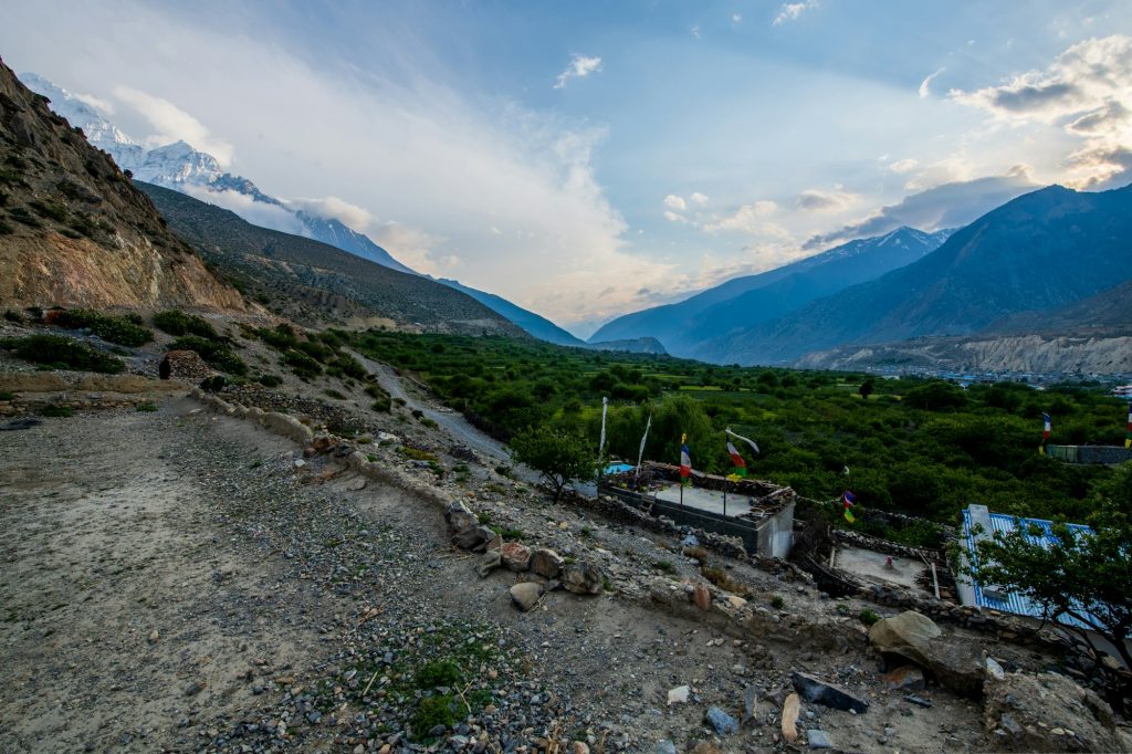
Above Ghasa the vegetation changes to pine and juniper, the road eases, and the valley opens between Dhaulagiri (8,167 m) and Annapurna I (8,091 m). Stop at Lete or Kalopani for the view of the Dhaulagiri icefall. This is the deepest part of the gorge — the summits on either side are more than 5,500 m above the river.
Tukuche to Jomsom: into the rain shadow
Suddenly the landscape is bare, brown and windswept. Tukuche’s old merchant houses and Marpha’s white lanes mark the Thakali heartland. From late morning the wind races up the riverbed; aim to reach Jomsom by early afternoon.
Jomsom to Muktinath: the final climb
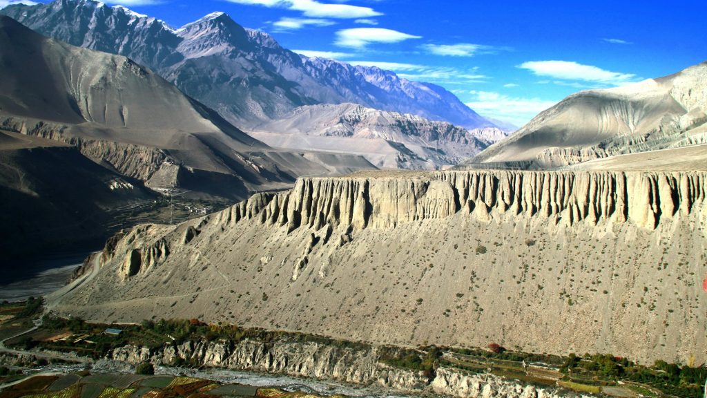
Smooth blacktop to Kagbeni, a medieval village at the gateway to Upper Mustang, then a climb of nearly 900 m on switchbacks through Khinga and Jharkot to Ranipauwa, with Dhaulagiri and Nilgiri behind you. Take it slowly — this is where the altitude starts to bite.
Jeep, bus or motorbike: which is best?
| Bus | Jeep | Motorbike | |
|---|---|---|---|
| Comfort | Low; crowded and bumpy | Moderate | Depends on your riding experience |
| Flexibility | None | High (private) | Total |
| Cost per person | Lowest | Moderate (shared) to high (private) | Moderate |
| Safety | Varies with operator | Good with a careful driver | Depends on skill and gear |
| Experience | Functional | Good | The best way to see the valley |
For groups of four or more who do not ride, a private jeep with a good driver is the best balance. For riders, nothing beats doing it on two wheels — our guided tour adds a mechanic and support vehicle for peace of mind.
Safety and landslides
- Check road conditions before leaving Pokhara between June and October; local news and jeep drivers at Baglung bus park are the best sources.
- Avoid travelling during or immediately after heavy rain; landslides and rockfall are most likely then.
- If you meet a landslide being cleared, wait — do not try to cross while debris is still moving.
- Keep a spare day in your schedule, especially before an international flight.
- Travel only in daylight.
Frequently asked questions
How far is Muktinath from Pokhara?
About 175–190 km by road: around 155–158 km to Jomsom and 20–25 km more to Muktinath.
How long does it take from Pokhara to Muktinath?
About 9–12 hours of driving, usually split over two days.
How far is Pokhara to Jomsom?
About 155–158 km by road, or 20–25 minutes by air when flights are operating.
How far is Jomsom to Muktinath?
About 20–25 km, roughly an hour by jeep or motorbike.
Is the road to Muktinath paved?
Mostly. Pokhara–Beni and Jomsom–Muktinath are paved, and much of Beni–Jomsom has been blacktopped, but rough sections remain in the gorge around Rupse and Ghasa.
Can I go to Muktinath by car?
A 4WD jeep is recommended. Ordinary cars struggle on the rough gorge sections.
Is there a direct bus from Pokhara to Muktinath?
No. Change at Beni and usually at Jomsom.
Are Pokhara–Jomsom flights running?
Regular flights were suspended from around 20 October 2026; check the current status before planning.
Do I need a permit for Muktinath?
Yes, the ACAP permit. No restricted-area permit is needed.
Can I ride a motorbike from Pokhara to Muktinath?
Yes, with a motorcycle licence, an IDP and an ACAP permit. A dual-sport bike is best.
Ride Pokhara to Muktinath with a guide
Six days, a mechanic behind you and every lodge booked.