Jomsom, Nepal: Travel Guide, Altitude and How to Get There
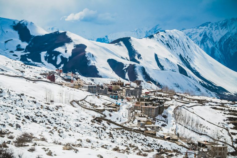
Jomsom is the headquarters of Mustang district and the hub of the upper Kali Gandaki valley: a windswept strip of lodges, government offices, apple-brandy bars and an airstrip on both banks of the river, beneath the white wall of Nilgiri. Most people pass straight through on the way to Muktinath or Upper Mustang — but Jomsom deserves a night, and on a motorbike or in a jeep it is the obvious base for exploring Lower Mustang.
This guide covers where Jomsom is and why it is so windy, how to get there from Pokhara by road or air (and the current state of both), what to do in and around town, where to stay, money and facilities, riding tips and the best time to visit.
| Jomsom at a glance | |
|---|---|
| Altitude | About 2,720 m (8,900 ft) |
| Role | District headquarters of Mustang; Ward 4 of Gharpajhong Rural Municipality |
| Name | From Tibetan “Dzong Sampa”, meaning “new fort” |
| From Pokhara | About 155 km by road (7–9 hours by jeep); 20–25 minutes by air when flights operate |
| To Marpha / Kagbeni / Muktinath | About 6–7 km / 10–11 km / 20–25 km |
| Climate | Cold semi-arid; about 292 mm of rain a year; strong afternoon wind |
| Permit | ACAP (NPR 3,000 for foreigners) |
| People | Mainly Thakali, plus Baragaun and Tibetan communities |
In this guide
- Where is Jomsom?
- Why is Jomsom so windy?
- A short history
- Getting to Jomsom by road
- Flying to Jomsom
- Things to do in Jomsom
- Day trips from Jomsom
- Where to stay and eat
- Money, health and connectivity
- Riding to and around Jomsom
- Best time to visit Jomsom
- Altitude
- Jomsom weather month by month
- Thakali culture and food
- Jomsom and the Annapurna Circuit
- How long to spend in Jomsom
- FAQs
Where is Jomsom?
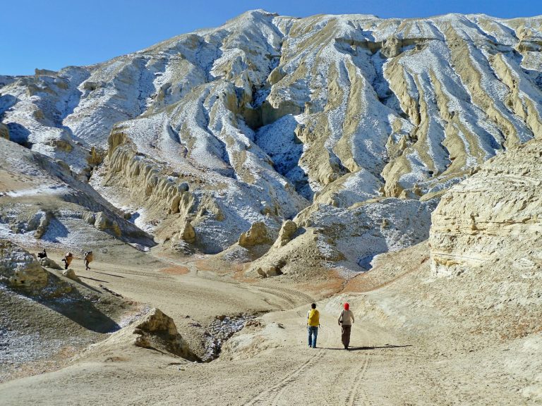
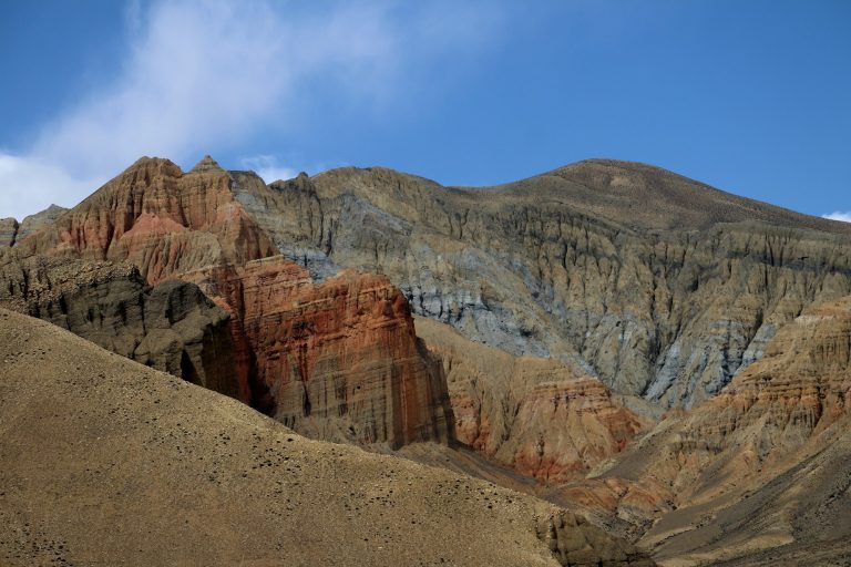
Jomsom lies on the Kali Gandaki river in Lower Mustang, in Nepal’s Gandaki Province. To the south rise the Dhaulagiri and Annapurna massifs; to the north the valley opens towards Kagbeni and the restricted region of Upper Mustang. Nilgiri North (7,061 m) towers directly above the town.
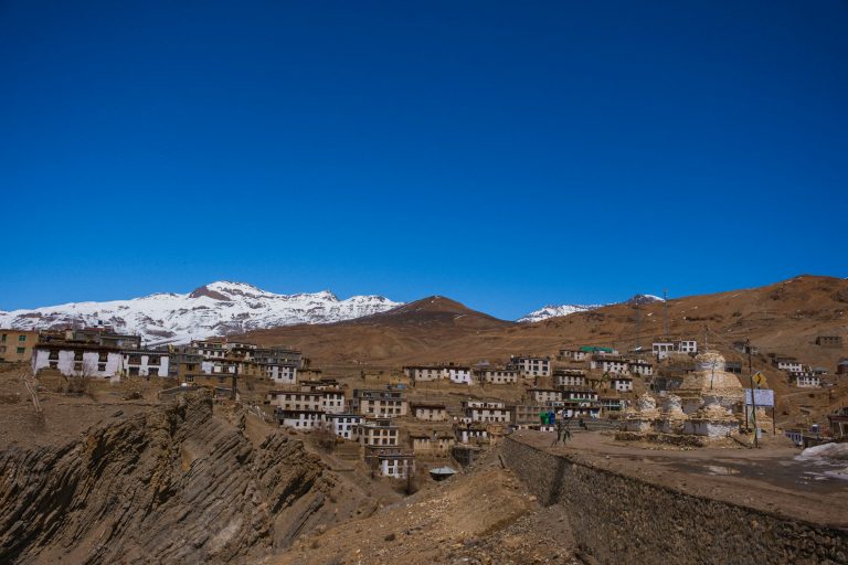
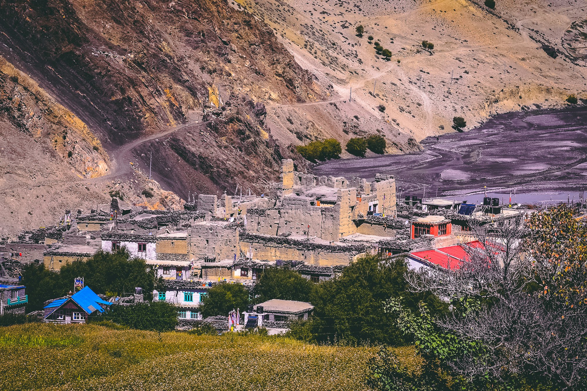
The town is split by the wide, stony riverbed. The western bank has the old village, with flat-roofed stone houses and narrow lanes; the eastern bank has the airport, the main bazaar of hotels and shops, government offices and the Mustang Eco Museum. Across a footbridge to the east is the older village of Thini, which predates Jomsom.
Why is Jomsom so windy?
Every day, from late morning, a powerful wind funnels up the Kali Gandaki gorge from the south. As the sun heats the dry plateau of Mustang, air is drawn up from the lower, cooler valleys — and the deep, narrow gorge acts like a wind tunnel. By midday it can gust at 40–50 knots on the airstrip, throwing up sand and grit.
The wind shapes everything in Jomsom: flights operate only in the early morning, riders and jeep drivers try to finish by early afternoon, and the houses are built low and close together around sheltered courtyards. Mornings, by contrast, are usually calm and crystal clear.
A short history
Jomsom grew up as a stop on the salt trade route between Tibet and the Indian plains. For centuries the Thakali people of the upper Kali Gandaki controlled this trade, running inns and warehouses and becoming famous across Nepal as traders and cooks — the “Thakali set” of dal bhat is now served everywhere in the country. Thini, across the river, is the older settlement, with a gompa and a fort said to date back to the days of the Thini kings.
The airstrip opened Jomsom to trekkers in the 1970s and 80s, and for decades the only way in for most visitors was by plane or on foot along the Annapurna Circuit. The road from Beni reached Jomsom in the 2000s, and it is now being upgraded as part of the Kaligandaki Corridor highway to the Tibetan border.
Getting to Jomsom by road
From Pokhara, the road runs west to Beni (about 80–90 km, paved) and then follows the Kali Gandaki north through Tatopani, Ghasa, Lete, Kalopani, Tukuche and Marpha to Jomsom — about 155 km in total. By March 2025, around three-quarters of the Beni–Kagbeni road had been blacktopped; the rest, mostly in the gorge around Rupse and Ghasa, is gravel and rock.
| Option | Time | Approx. cost |
|---|---|---|
| Local bus (change at Beni and/or Ghasa) | 8–10 hours | A few thousand NPR |
| Shared jeep | 7–9 hours | Per seat; ask at Pokhara’s Baglung bus park |
| Private jeep | 7–9 hours (better over 2 days) | About USD 300–450 per vehicle |
| Direct bus from Kathmandu | 15–16 hours | About USD 20 |
| Motorbike | 2 days at a comfortable pace | Bike hire plus fuel |
Fares are approximate and change with fuel prices. Our Pokhara to Muktinath road guide breaks the route down section by section.
October 2026: floods in late September blocked the Beni–Jomsom road in more than 50 places; it reopened on 9 October. Expect disruption every monsoon (June to early October).
Make Jomsom part of a ride
Our Pokhara to Muktinath tour stops in Tatopani, Marpha, Jomsom and Kagbeni — with a guide and mechanic behind you.
Flying to Jomsom
The Pokhara–Jomsom flight is one of the most dramatic in the world: 20–25 minutes in a small Twin Otter through the Kali Gandaki gorge, with Dhaulagiri and Annapurna I filling the windows. Tara Air and Summit Air operate the route; fares for foreigners have typically been around USD 120–180 one way.
- Flights run only in the early morning, before the wind picks up.
- Delays and cancellations because of cloud and wind are common. Build in a spare day.
- The route is seasonal: flights were suspended over winter 2025–26, and regular flights were suspended again from around 20 October 2026. Check the current status before planning around a flight.
- There are no direct flights from Kathmandu; connect in Pokhara.
- Baggage limits are strict, often 10–15 kg checked.
With flights unreliable, the road has become the dependable way to reach Jomsom — one more reason to ride.
Things to do in Jomsom
- Mustang Eco Museum — about five minutes’ walk south of the airport. Set up in 1992 and run by ACAP since 1997, it covers Mustang’s culture, Tibetan medicine and herbs, flora and fauna, with a small monastery room.
- Thini village and gompa — a 30-minute walk east across the river; an old village with a monastery and the remains of an ancient fort.
- Dhumba Lake — a small, green, sacred lake about an hour’s walk or a short ride beyond Thini, with views of Nilgiri. Its fish are considered sacred and are never caught.
- Syang — a quiet village with two monasteries, 30 minutes north on foot.
- Shaligram hunting — search the Kali Gandaki riverbed for black ammonite fossils, sacred to Hindus as forms of Vishnu.
- Apple everything — apple brandy, apple cider, dried apples, apple pie and apple crumble in every bakery.
- Sunrise on Nilgiri — climb to any rooftop at dawn as the first light hits the peak.
Day trips from Jomsom
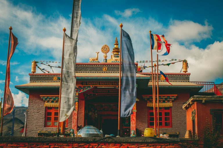
- Marpha (6–7 km south) — the most beautiful Thakali village, with whitewashed lanes, a Nyingma monastery, orchards and distilleries. See Kagbeni and Marpha.
- Chhairo — a Tibetan settlement and old Nyingma gompa just south of Marpha.
- Tukuche — once the main Thakali trading town, with grand old merchant houses and a distillery.
- Kagbeni (10–11 km north) — the medieval gateway to Upper Mustang.
- Muktinath (20–25 km) — the sacred temple and its 108 spouts. See the Muktinath temple guide.
- Lubra — a village of the ancient Bon religion in the Panchgaun valley, with a monastery said to be around 800 years old.
- Dhaulagiri icefall viewpoint — a hike from near Marpha or Tukuche towards the icefall and Dhaulagiri base area; ask locally about trail conditions.
Where to stay and eat
Jomsom has accommodation for every budget: simple lodges from about USD 10–20, comfortable mid-range hotels at USD 25–60 with attached bathrooms and hot showers, and upmarket options at USD 80–150 or more. Just outside town, the luxury Shinta Mani Mustang offers a very different kind of stay. Many travellers prefer to sleep in Marpha, which is quieter and prettier, and visit Jomsom for supplies.
Food is excellent. Thakali dal bhat — rice, lentil soup, vegetable curries, pickles and often buckwheat specialities — is the staple, usually with free refills. Look also for buckwheat pancakes, Tibetan bread, yak cheese, momos and the famous apple pie.
Money, health and connectivity
- ATMs: Jomsom has banks and ATMs, but they can run out of cash or go offline. Bring enough Nepali rupees for your whole Mustang trip.
- Hospital: the provincial hospital in Jomsom is the only hospital in Mustang district and treats altitude sickness; serious cases are transferred to Pokhara.
- Phone and internet: Nepal Telecom and Ncell both work in town; most hotels have Wi-Fi.
- Fuel and mechanics: Jomsom has fuel and mechanics familiar with Royal Enfields and jeeps — the most reliable service point in the valley.
- Permits: ACAP permits are checked at the Jomsom checkpoint. Upper Mustang permits are checked at Kagbeni.
Riding to and around Jomsom
- Leave Tatopani or Marpha early to reach Jomsom before the wind; by early afternoon, the riverbed sections can be a sandblasting ordeal.
- North of Jomsom the road to Kagbeni is blacktopped, but the riverbed tracks around it are loose gravel — stand up and keep momentum.
- Fill up in Jomsom before heading to Muktinath or Upper Mustang.
- Carry your licence, IDP, bike papers and ACAP permit for the checkpoints.
- In winter, mornings are well below freezing; wait for the sun before riding.
Ride it with us on the Pokhara to Muktinath motorbike tour, or rent a bike via motorbike rental in Pokhara.
Best time to visit Jomsom
| Season | Weather in Jomsom | Getting there |
|---|---|---|
| Spring (Mar–May) | Warm days (15–21°C), windy afternoons, blossom | Road good; flights usually running |
| Monsoon (Jun–Aug) | Dry, mild (22–23°C), little rain | Road landslides likely; flights unreliable |
| Autumn (Sep–Nov) | Clear, crisp, best views; apple harvest | Road good after mid-October; busiest |
| Winter (Dec–Feb) | Sunny but cold; nights to −2°C or lower; occasional snow | Road usually open; flights often suspended |
Average temperatures from Nepal’s Department of Hydrology and Meteorology. See the best time to visit Mustang for a month-by-month guide.
Altitude
At about 2,720 m, Jomsom is high enough that some people feel mild altitude effects — headache, poor sleep, breathlessness on stairs — especially if they arrive directly from Pokhara by air. It is an ideal place to spend a night before going higher to Muktinath (3,710–3,800 m) or Upper Mustang. Read about altitude sickness in Mustang.
Jomsom weather month by month
These are official 1991–2020 climate normals for Jomsom’s weather station from Nepal’s Department of Hydrology and Meteorology. Note how little rain falls even in July and August — the rain shadow at work.
| Month | Avg max | Avg min | Rain (mm) |
|---|---|---|---|
| Jan | 10.4°C | −1.9°C | 14 |
| Feb | 11.8°C | −0.6°C | 21 |
| Mar | 15.2°C | 2.0°C | 30 |
| Apr | 18.6°C | 4.4°C | 21 |
| May | 20.6°C | 7.8°C | 19 |
| Jun | 22.6°C | 12.1°C | 32 |
| Jul | 22.8°C | 14.1°C | 47 |
| Aug | 22.6°C | 13.8°C | 44 |
| Sep | 21.3°C | 11.5°C | 36 |
| Oct | 18.0°C | 5.5°C | 18 |
| Nov | 14.8°C | 1.5°C | 5 |
| Dec | 12.3°C | −1.2°C | 5 |
Wind chill makes afternoons feel much colder than these numbers suggest. Pack a windproof layer whatever the month.
Thakali culture and food
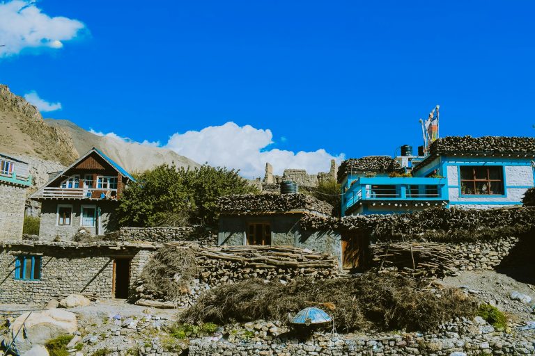
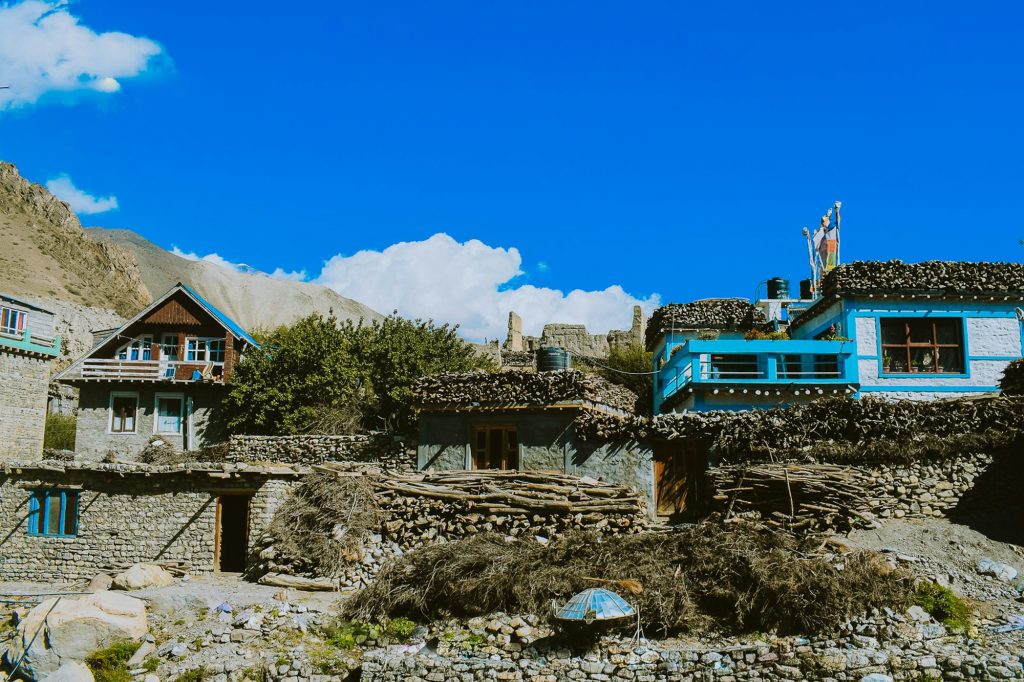
The Thakali are the people of Thak Khola, the upper Kali Gandaki between Ghasa and Jomsom. Historically they were salt traders and customs agents on the Tibet route, and many became wealthy merchants, lodge-owners and, later, entrepreneurs across Nepal. Their villages — Marpha, Tukuche, Kobang, Larjung — are known for orderly stone architecture, flat roofs stacked with firewood and courtyards built against the wind.
Thakali food has become Nepal’s favourite restaurant cuisine. A Thakali set includes rice (or buckwheat dhido), black lentil soup, seasonal vegetable curries, spinach, pickles (achar), sometimes dried meat, and ghee, all refilled until you are full. In Jomsom and Marpha try buckwheat pancakes with honey, apple brandy (local spirits are strong — around 40% ABV) and the apple pies sold at every bakery.
Culturally, many Thakali follow a blend of Tibetan Buddhism, Bon and Hindu practice. The Thakali hold their own festivals and clan rituals, and their communities run local cultural centres and museums — Tukuche and Marpha are good places to learn more.
Jomsom and the Annapurna Circuit
For trekkers, Jomsom is the traditional finishing point of the Annapurna Circuit: after crossing the Thorong La (5,416 m) and descending to Muktinath, many walkers follow the valley down to Jomsom and fly out to Pokhara. Since the road arrived, most trekkers either take a jeep from Muktinath or Jomsom, or follow quieter alternative trails on the east bank of the river via Lubra, Thini and Marpha.
Jomsom is also the starting point for treks into Upper Mustang (with a restricted-area permit), to Tilicho Lake via Thini and Mesokanto La, and down the Kali Gandaki to Tatopani and Ghorepani.
How long to spend in Jomsom
- One night: arrive by road in the afternoon, walk to Thini and Dhumba Lake the next morning, then continue to Kagbeni or Muktinath.
- Two nights: add a day trip to Marpha and Tukuche, or ride to Lubra.
- Base for a week: use Jomsom or Marpha as a base for day rides and walks across Lower Mustang, with a night in Kagbeni and Muktinath.
On our Lower Mustang and Muktinath motorbike tour, riders spend nights in Marpha, Kagbeni and Jomsom to get the most out of the valley.
Frequently asked questions
What is the altitude of Jomsom?
About 2,720 m (8,900 ft); sources range from about 2,700 to 2,743 m.
Where is Jomsom located?
In Lower Mustang, north-central Nepal, on the Kali Gandaki river about 155 km north of Pokhara by road.
How do I get from Pokhara to Jomsom?
By road via Beni (7–9 hours by jeep, or two days by motorbike), or by a 20–25 minute morning flight when the seasonal service is running.
Are Pokhara–Jomsom flights running now?
Regular flights were suspended from around 20 October 2026. Check with Tara Air or Summit Air for the current schedule.
What is Jomsom famous for?
Its spectacular setting beneath Nilgiri, the afternoon wind, apple products, Thakali culture and as the gateway to Muktinath and Upper Mustang.
Do I need a permit for Jomsom?
Foreigners need an ACAP permit (NPR 3,000). No restricted-area permit is needed.
Is there an ATM in Jomsom?
Yes, but it can be unreliable; carry enough cash.
How far is Jomsom from Muktinath?
About 20–25 km — around an hour by jeep or motorbike.
Can you reach Jomsom by train?
No. There is no railway in this part of Nepal; travel is by road or air.
What does Jomsom mean?
The name comes from the Tibetan “Dzong Sampa”, meaning “new fort”.
Ride to Jomsom and beyond
Our six-day tour from Pokhara takes in Tatopani, Marpha, Jomsom, Kagbeni and Muktinath.