Mustang, Nepal: A Complete Guide for Riders and Travellers
Mustang is the part of Nepal that lies behind the Himalaya. North of the Annapurna and Dhaulagiri massifs, the Kali Gandaki river has cut a corridor up to the Tibetan plateau, and along it sit whitewashed Thakali villages, mud-walled Tibetan towns, cave-riddled cliffs in every shade of red and ochre, and the walled city of Lo Manthang — capital of a kingdom that kept its own king until 2008.
It is also the most sought-after motorbike ride in the country. This guide covers everything you need to plan a trip: the difference between Lower and Upper Mustang, how to get there and what the road is really like in 2026, permits and the new per-day fee, when to go, altitude, where to stay, money and phone signal, and the sights that are worth the dust. It is written for riders, but it works just as well if you are travelling by jeep or on foot.
| Mustang at a glance | |
|---|---|
| Where | North-central Nepal, Gandaki Province, bordering Tibet (China) |
| District HQ | Jomsom (about 2,720 m) |
| Area | About 3,570 km²; Upper Mustang is the northern part, roughly 2,000 km² |
| Altitude of main stops | Marpha ~2,670 m · Jomsom ~2,720 m · Kagbeni ~2,810 m · Muktinath ~3,710–3,800 m · Lo Manthang ~3,800 m |
| Climate | Rain shadow: Jomsom averages under 300 mm of rain a year; strong afternoon wind |
| People | Thakali in Lower Mustang; Loba (Lhopa), of Tibetan culture, in Upper Mustang |
| Permits | ACAP for all of Mustang; Restricted Area Permit + licensed guide north of Kagbeni |
| Getting there | Road from Pokhara via Beni (about 155 km to Jomsom), or seasonal flights Pokhara–Jomsom |
In this guide
- Where is Mustang?
- Lower Mustang vs Upper Mustang
- A short history of Mustang
- How to get to Mustang
- Permits for Mustang
- The best things to see in Mustang
- When to visit Mustang
- Festivals
- Altitude and health
- Practical information: money, phone, power and lodging
- Riding Mustang: tips for motorcyclists
- Sample Mustang itineraries
- FAQs
Where is Mustang?
Mustang is a district in Gandaki Province in north-central Nepal. Its southern edge is the deep Kali Gandaki gorge between Dhaulagiri (8,167 m) and Annapurna I (8,091 m); its northern edge is the border with the Tibet Autonomous Region of China. Pokhara, Nepal’s second city, is about 155 km south of Jomsom by road.
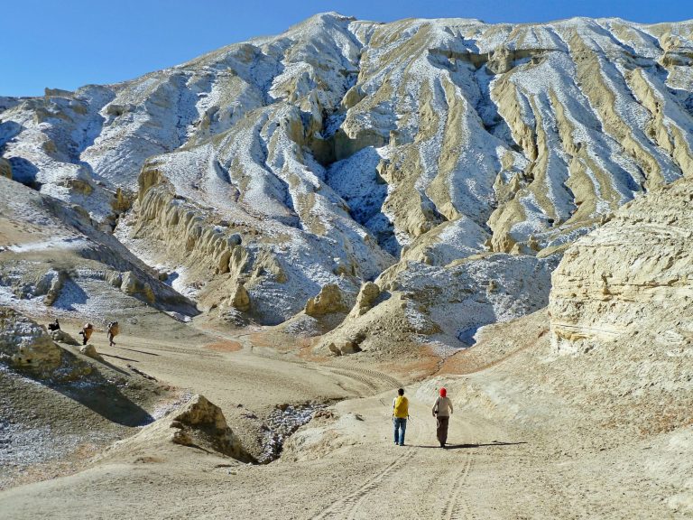
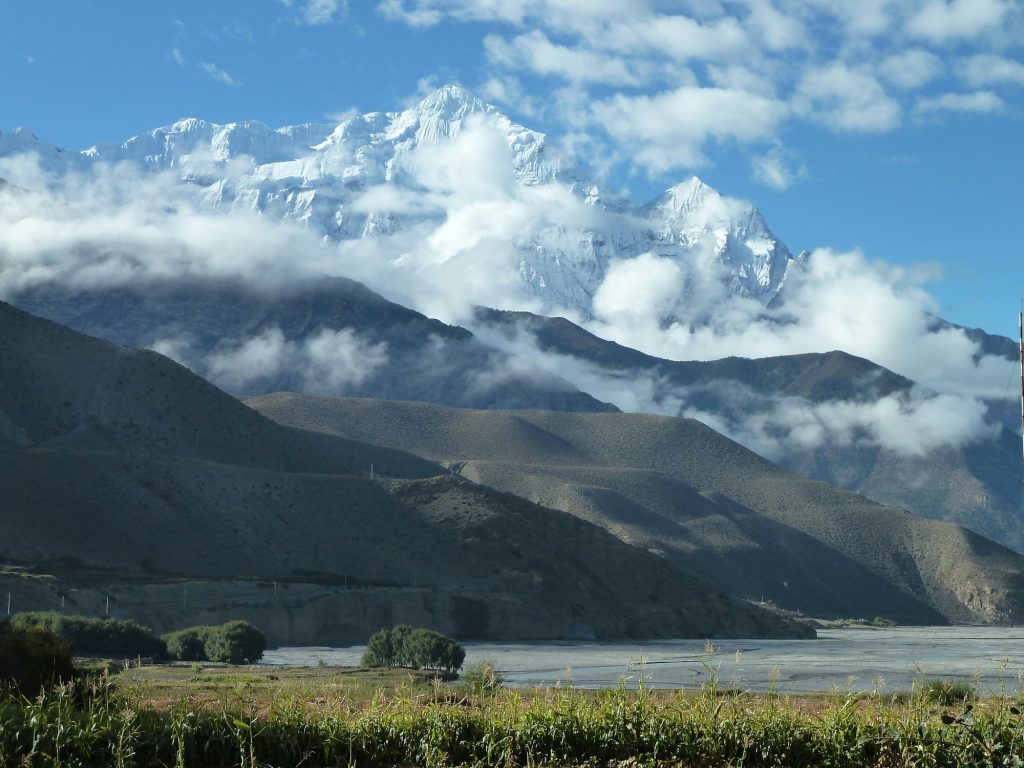
Because the main Himalayan range sits to the south, Mustang lies in a rain shadow. The monsoon clouds that soak Pokhara with more than 3,000 mm of rain a year are wrung out before they reach the trans-Himalaya: official climate normals for Jomsom record an average of about 292 mm a year. That is why the landscape changes so dramatically as you ride north — from rice terraces and banana trees at Beni, through pine forest at Ghasa and Lete, to a bare, wind-eroded desert above Kagbeni.
Lower Mustang vs Upper Mustang
Mustang divides neatly into two halves, and the line between them — just north of the village of Kagbeni — decides almost everything about your trip: the permit, the cost, whether you need a guide and what the road is like.
Lower Mustang
Lower Mustang runs from the Kali Gandaki gorge at Ghasa up through Lete, Tukuche, Marpha and Jomsom to Kagbeni, plus the side valley to Muktinath. It is the land of the Thakali people — traders and innkeepers who for centuries ran the salt route between Tibet and India — and their villages are tidy, whitewashed and prosperous. Lower Mustang is open to everyone with an ACAP permit, has comfortable lodges and a road that is now largely paved. Most visitors, and almost all Indian pilgrims heading for Muktinath, never go further.
Upper Mustang
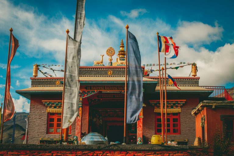
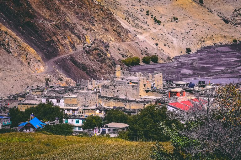
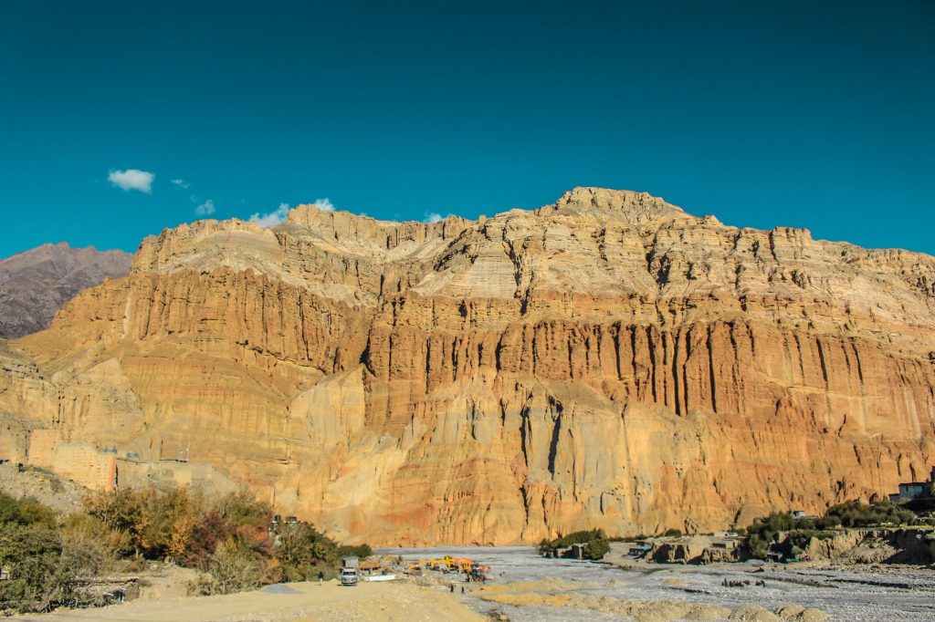
Upper Mustang is the former Kingdom of Lo, north of Kagbeni to the Tibetan border. It was closed to foreigners until 1992 and remains a restricted area. The people are Loba, culturally Tibetan and mostly followers of the Sakya school of Tibetan Buddhism. Villages are built of mud brick around monasteries and chortens, fields are irrigated barley in a desert, and the cliffs are honeycombed with thousands of man-made caves. Fewer than 5,000 foreigners visit in a typical year.
| Lower Mustang | Upper Mustang | |
|---|---|---|
| Area | Ghasa to Kagbeni, plus Muktinath | North of Kagbeni to Lo Manthang and Kora La |
| People | Thakali, plus Baragaun villages around Muktinath | Loba (Lhopa), Tibetan culture |
| Permit | ACAP (NPR 3,000) | Restricted Area Permit + ACAP |
| Guide | Not required for riders and drivers | Licensed guide and registered agency required |
| Road | Mostly paved Beni–Jomsom–Muktinath, rough gorge sections | Mostly gravel and dirt north of Kagbeni |
| Lodges | Plentiful, some upmarket | Simple teahouses; newer lodges in Lo Manthang |
| Self-ride? | Yes | No — guided only |
| Key sights | Kali Gandaki gorge, Marpha, Jomsom, Kagbeni, Muktinath | Lo Manthang, Ghar Gompa, Dhakmar cliffs, Chhoser caves, Tsarang |
If you have four to six days, Lower Mustang is a superb trip in its own right — see our Pokhara to Muktinath motorbike tour. If you have ten days or more, Upper Mustang is the one you will talk about for years: see the Upper Mustang motorbike tour.
A short history of Mustang
The Kingdom of Lo was founded in 1380 by the warrior king Ame Pal, and its walled capital Lo Manthang — with its palace and great monasteries — took shape over the following century. For three hundred years Lo prospered by controlling the trade in Tibetan salt and wool heading south and grain heading north, and its rulers sponsored monasteries such as Jampa and Thubchen, whose 15th-century murals are among the finest in the Tibetan world.
Lo was absorbed into the Gorkha kingdom of Nepal in the late 18th century but kept its hereditary raja and a large degree of autonomy. When Nepal abolished its own monarchy in 2008, the title of the Raja of Mustang went with it. The last king, Jigme Dorje Palbar Bista, died in 2016.
Upper Mustang’s isolation was deepened by politics: in the 1960s it was a base for Tibetan Khampa guerrillas fighting the Chinese, and Nepal kept the region closed to outsiders until 1992. A road from the Tibetan border reached Lo Manthang in the early 2000s; the road from the south followed, and today the Kaligandaki Corridor highway is being upgraded from Beni all the way to the border at Kora La.
How to get to Mustang
By road from Pokhara
The Beni–Jomsom–Kora La road leaves the paved Pokhara–Baglung highway at Beni and follows the Kali Gandaki north. Pokhara to Jomsom is about 155 km. By March 2025 roughly three-quarters of the 100 km between Beni and Kagbeni had been blacktopped, including Beni–Tatopani, Tatopani–Kobang and Jomsom–Kagbeni. The sections still unsealed are mostly in the gorge around Rupse, Ghasa and Lete, where landslides and rockfall are a constant battle.
By jeep or bus, Pokhara to Jomsom takes 7–9 hours, usually with a change of vehicle at Beni or Ghasa; private jeeps cost roughly USD 250–450 per vehicle. On a motorbike, plan two days with a night at Tatopani or Marpha. Our Pokhara to Muktinath road guide breaks it down section by section.
Road update, October 2026: heavy rain in late September 2026 blocked the Beni–Jomsom road in more than 50 places and washed out a section at Kunauta in Myagdi. The road reopened on 9 October. Monsoon closures like this are normal — always check conditions before you travel between June and early October.
By air
Tara Air and Summit Air fly small Twin Otter aircraft between Pokhara and Jomsom, a spectacular 20–25 minute flight through the gorge. Flights operate only in the early morning, before the valley wind picks up, and are often delayed or cancelled. The route is also seasonal: flights were suspended over the 2025–26 winter, and regular services were suspended again from around 20 October 2026. Never rely on a flight for a tight connection, and check the current schedule before you plan around it.
By motorbike
Riding is the best way to see Mustang, because you can stop wherever the view stops you. Lower Mustang can be self-ridden with an ACAP permit and a bike from a Pokhara rental shop. Upper Mustang can only be ridden with a licensed guide, which is why it is offered as a guided tour. If you have never ridden in Nepal, read riding a motorbike in Nepal as a foreigner first.
Want to ride Mustang?
Lower Mustang in six days from Pokhara, or the full ride to Lo Manthang with permits, guide and mechanic sorted.
Permits for Mustang
ACAP (Annapurna Conservation Area Permit). All of Mustang is inside the Annapurna Conservation Area. Foreign nationals pay NPR 3,000 (SAARC nationals NPR 1,000; children under 10 free). Buy it in advance at the Nepal Tourism Board office in Kathmandu or Pokhara, or online through the NTNC e-permit system — buying at a checkpoint costs double. It is checked at several points along the road, including Ghasa and Jomsom.
Restricted Area Permit (RAP) for Upper Mustang. North of Kagbeni you also need a RAP from Nepal’s Department of Immigration. For years the fee was a flat USD 500 per person for the first 10 days, then USD 50 a day. In November 2025 Nepal’s cabinet approved replacing this with USD 50 per person per day, so you pay only for the days you actually spend in the restricted zone — a big saving for a three- or four-day motorbike visit. Some agencies still quote the old fee, so confirm which applies on your travel dates.
The RAP is issued only through a registered Nepali agency; you must be accompanied by a licensed guide, and the rule of a minimum of two foreigners per permit still generally applies. Full details are in our Upper Mustang permit guide.
The best things to see in Mustang
Lower Mustang
- The Kali Gandaki gorge — between Dhaulagiri and Annapurna I, the river runs more than 5 km below the summits on either side, which is why it is often described as the deepest gorge on Earth.
- Tatopani hot springs — riverside pools at about 1,200 m, perfect after a day in the gorge.
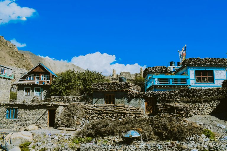
- Marpha — the most beautiful Thakali village, with flagstone lanes, firewood stacked on flat roofs, a Nyingma monastery, apple orchards and the famous apple brandy.
- Jomsom — the district headquarters, with the Mustang Eco Museum, Thini village and sacred Dhumba Lake nearby. See our Jomsom guide.
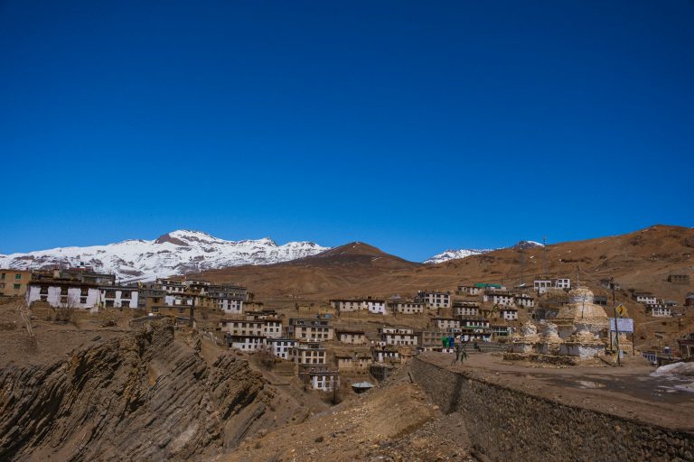
- Kagbeni — a medieval maze of mud-brick houses and tunnels around the 15th-century Kag Chode monastery, at the gateway to Upper Mustang. See Kagbeni and Marpha.
- Muktinath — a temple sacred to Hindus and Buddhists, with 108 water spouts and a natural gas flame burning over a spring. See our Muktinath temple guide.
- Jharkot and Jhong — old fortified villages in the Muktinath valley with views into Upper Mustang.
- Lubra — a village of the pre-Buddhist Bon religion in a side valley near Jomsom.
Upper Mustang
- Lo Manthang — the walled capital, with its palace and the 15th-century Jampa and Thubchen monasteries. Read the full Lo Manthang guide.
- Ghar Gompa (Lo Gekar) — near Ghami and traditionally linked to Guru Rinpoche in the 8th century; often called the oldest monastery in Mustang.
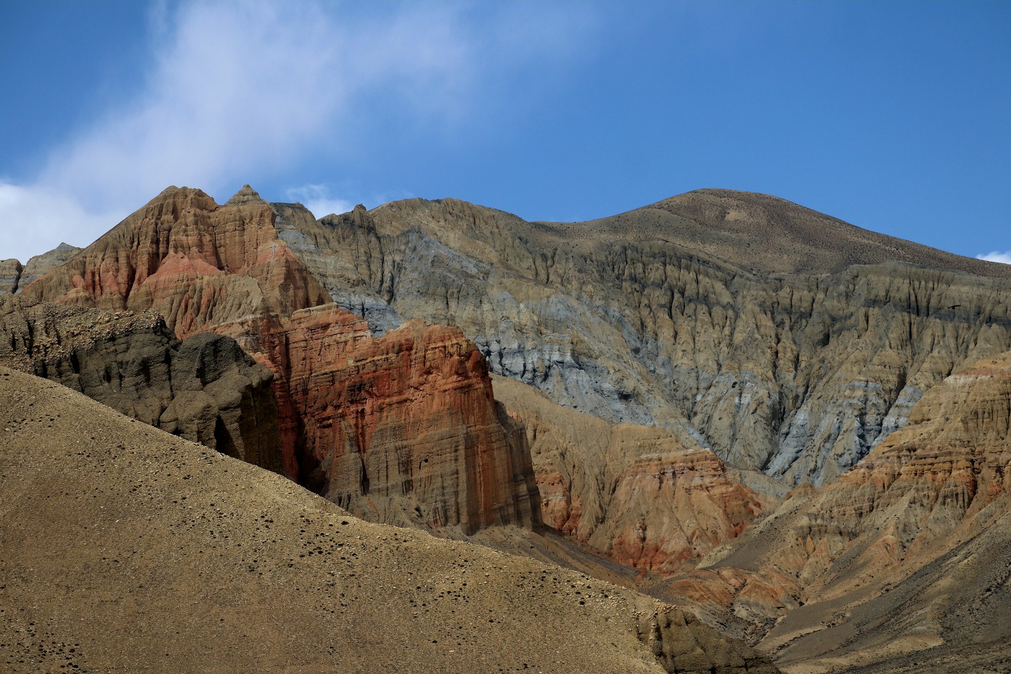
- Dhakmar — vivid red cliffs which, legend says, were stained by the blood of a demoness slain by Guru Rinpoche.
- Ghami’s mani wall — one of the longest in Nepal, said to be the demoness’s intestines.
- Tsarang — an old palace and a large red monastery above a green oasis.
- Chhoser and the Jhong cave — a five-storey complex of cave dwellings north of Lo Manthang, with the cliff-side Nyiphu and Garphu monasteries nearby.
- The sky caves — around 10,000 man-made caves across Mustang, some used as homes, tombs and meditation chambers more than 2,000 years ago.
- Damodar Kunda — high sacred lakes revered by Hindus, several days east of Lo Manthang.
When to visit Mustang
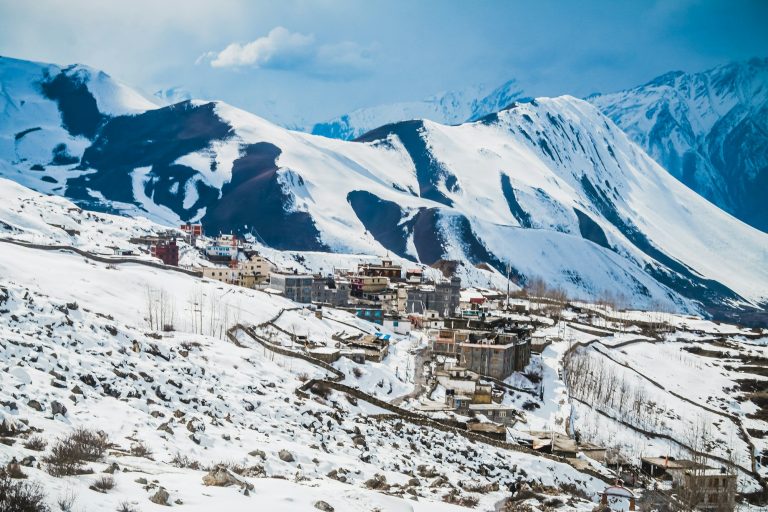
Spring (March–May) and autumn (late September–November) are best for Mustang as a whole. Because of the rain shadow, Upper Mustang is also open and dry during the monsoon (June–August), when its barley fields are green — the catch is getting there, because the road below Jomsom is prone to landslides. Winter (December–February) is bitterly cold: nights in Lo Manthang have dropped to −15°C or lower, many residents move south and most Upper Mustang lodges close, though Lower Mustang stays open.
| Month | Jomsom avg max / min | Rain (mm) |
|---|---|---|
| January | 10°C / −2°C | 14 |
| April | 19°C / 4°C | 21 |
| July | 23°C / 14°C | 47 |
| October | 18°C / 6°C | 18 |
| December | 12°C / −1°C | 5 |
Source: Nepal Department of Hydrology and Meteorology normals for Jomsom (1991–2020). Lo Manthang, about 1,100 m higher, is typically around 6°C colder. Our full guide to the best time to visit Mustang goes month by month, with festival dates.
Festivals
- Tiji — a three-day festival of masked cham dances in Lo Manthang’s palace square, performed by the monks of Chode monastery to re-enact the victory of the deity Dorje Jono over a demon. It is set by the Tibetan calendar and usually falls in May.
- Yartung — a late-summer horse festival (usually August) with racing, archery and dancing, held in Lo Manthang and in the villages around Muktinath.
- Apple harvest — mid-September to October in Marpha, Tukuche and Kagbeni, with an apple-picking festival at the Marpha horticulture centre.
- Dashain and Tihar — Nepal’s biggest national festivals (October–November) bring a surge of domestic tourists, bikers and jeeps to Mustang.
Altitude and health
Most of Mustang sits between 2,600 m and 3,900 m, and the passes on the way to Lo Manthang reach about 4,000 m. That is high enough for acute mountain sickness, especially when you arrive by road from Pokhara (about 820 m) in a day or two. In the year to mid-July 2026, 16 visitors died of altitude sickness in Mustang, most of them pilgrims who drove straight up to Muktinath.
Follow the standard rule of not increasing your sleeping altitude by more than about 500 m a day above 3,000 m, spend a night in Marpha, Jomsom or Kagbeni before going higher, and descend if symptoms worsen. Read Upper Mustang altitude and altitude sickness on a motorbike for the details.
Practical information: money, phone, power and lodging
- Money: there are ATMs in Jomsom and around Muktinath, but they can run out of cash. There are none in Kagbeni or Upper Mustang. Carry enough Nepali rupees for the whole trip.
- Phone and internet: Nepal Telecom and Ncell work in most villages in Lower Mustang; Nepal Telecom has 3G in Lo Manthang. Signal is patchy in the gorge and between villages. Most lodges have Wi-Fi of varying quality.
- Electricity: grid power reaches most of Lower Mustang; Upper Mustang relies partly on solar, with cuts. Bring a power bank.
- Fuel: available in Beni, Jomsom and a few other places, with limited supply further north. Fill up whenever you can.
- Lodges: Lower Mustang has everything from simple teahouses at USD 10–20 to boutique hotels and the luxury Shinta Mani Mustang near Jomsom. In Upper Mustang, teahouses are simple but warm; Lo Manthang has several newer lodges.
- Food: Thakali dal bhat (rice, lentils, curries and pickles, usually refilled) is the staple and is excellent; you will also find momos, Tibetan bread, noodle soups, yak cheese and, of course, apple pie.
- Health: the provincial hospital in Jomsom is the only hospital in the district; serious cases go to Pokhara. Make sure your insurance covers helicopter evacuation at altitude.
Riding Mustang: tips for motorcyclists
- Ride early. From late morning a powerful wind blows up the Kali Gandaki valley; on the open riverbed near Jomsom it can push a bike sideways and fill everything with dust.
- Choose the right bike: a Royal Enfield Himalayan 411/450 or Honda CRF250L with dual-sport tyres. Scooters and road bikes struggle in the gorge. Our Himalayan 450 vs 411 comparison explains why.
- Expect river crossings and loose gravel north of Kagbeni; stand on the pegs and keep momentum.
- Carry your licence, International Driving Permit, rental papers and ACAP permit; checkpoints are frequent.
- Never ride in the gorge after heavy rain or after dark.
- Bike engines lose power at altitude — roughly 3% for every 300 m — so even fuel-injected bikes feel noticeably slower above 3,500 m.
Prefer someone else to handle all of this? Our Lower Mustang tour and Upper Mustang tour include a guide, mechanic, permits and lodges.
Sample Mustang itineraries
| Trip | Days | Route |
|---|---|---|
| Lower Mustang highlights | 4–6 from Pokhara | Pokhara – Tatopani – Marpha – Kagbeni – Muktinath – Jomsom – Tatopani – Pokhara |
| Lower Mustang from Kathmandu | 9–11 | Adds the Prithvi Highway, Bandipur and Pokhara |
| Upper Mustang by motorbike | 12–13 from Kathmandu | Lower Mustang, then Kagbeni – Chele – Ghami – Lo Manthang with a rest day, and back via Tsarang and Muktinath |
| Upper Mustang trek | 14–17 | Jomsom – Kagbeni – Chele – Syangboche – Ghami – Tsarang – Lo Manthang, returning by jeep or on foot |
Compare costs on our Nepal motorcycle tour prices page.
Frequently asked questions
Where is Mustang in Nepal?
In north-central Nepal in Gandaki Province, north of Pokhara and the Annapurna and Dhaulagiri ranges, bordering Tibet. Jomsom, the district headquarters, is about 155 km from Pokhara by road.
How do I get to Mustang from Pokhara?
By road via Beni (7–9 hours to Jomsom by jeep, or two days on a motorbike), or by a 20–25 minute morning flight to Jomsom when the seasonal service is running.
What is the difference between Upper and Lower Mustang?
Lower Mustang (Jomsom, Marpha, Kagbeni, Muktinath) needs only an ACAP permit. Upper Mustang, the former Kingdom of Lo north of Kagbeni, is a restricted area that requires a Restricted Area Permit and a licensed guide.
How much is the Upper Mustang permit?
Nepal approved a change in November 2025 from USD 500 for 10 days to USD 50 per person per day. You also need the ACAP permit (NPR 3,000). Confirm the current fee with your operator.
Can I visit Upper Mustang on my own?
No. You must go through a registered agency with a licensed guide, and generally in a group of at least two foreigners.
Is Mustang worth visiting?
Yes. It combines Himalayan scenery, a desert landscape and living Tibetan-Buddhist culture that is rare anywhere today, and it is reachable by road.
What is the best month to visit Mustang?
October for clear skies and the apple harvest; April and May for warmer weather and the Tiji festival. Upper Mustang is also good in the dry summer months.
Can you visit Mustang in winter?
Lower Mustang, yes — it is quiet, sunny and cold. Upper Mustang is very cold in winter and most lodges close.
Is there an ATM in Mustang?
Yes, in Jomsom and around Muktinath, but not in Upper Mustang. Carry cash.
Why is Mustang called the Forbidden Kingdom?
Because the Kingdom of Lo was closed to outsiders until 1992 and still requires a special permit today.
Ride Mustang with us
Lower Mustang in six days from Pokhara, or the full ride to Lo Manthang with permits, guide and mechanic included.